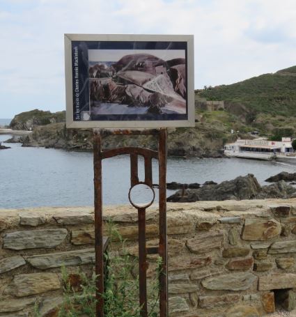
We are on the eastern shore of the harbour to the north (is this correct ?) on the road that bypasses the Redoubt Bear and Fort Mailly. This route is parallel to the road that goes from the Jetty Beach (Anse de la Jette) to the current commercial port.
The road is cut through the hills that line the bank, crossing two tunnels and the gap carved in the rock.L
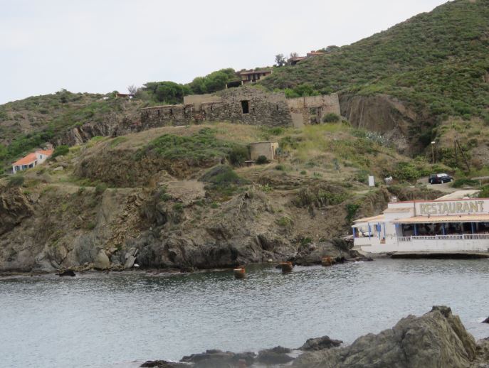
We are looking to the north-east. To the right of the watercolour the gap containing the road is carved into the rock; to the centre, at the top of the little hill, is the north-east face of the Fort Mailly. One can discern the entrance to the Fort and the access lane.
When CR Mackintosh carried out his work the fort was not in ruins as it is now.
In front of the Fort Mailly one is able to see a part of the Anse Christine (Christine Beach), where a restaurant has since been constructed “The Poisson Rouge”.
Pictorial analysis
“This is probably Mackintosh’s earliest surviving view of Fort Mailly on the outskirts of Port-Vendres. Perched on the Bear Redoubt, Mackintosh looks straight at the main entrance of the fort. The rock formations, hills and cuttings, create a dynamic mass around the rigid structure of the low-slung fort. At this stage Mackintosh’s handling of the sea is conventional. Mackintosh returned to a very similar view in his later watercolour ‘The Fort’. Translated from English with the kind authorisation of Professor Pamela Robertson – Glasgow University.
Mackintosh shows us here a graphic transposition almost independent of the initial subject, as the analysis of the surfaces generated by the light on the rock mass is so very detailed and taken to the extreme. The image is broken up into solid areas with little color. This is more a job of a developer than a colorist.
Historical guideline
As its name suggests, the Mailly Redoubt was constructed by Marshal De Mailly between 1772 and 1789, during the reign of Louis XVIth. It was equipped, like the Bear Redoubt, with defensively-walled cannons. The redoubt was rebuilt in1858 as part of the creation of the line of defence created in the Region in the nineteeth century (Port-Vendres having been declared a military port in 1846) ; then, more recently, in the years 1940 to 1944, during the occupation by the German army. It was blown up by German troops on August 19th 1944. It remains in ruins which belong to the municipality of Port-Vendres.